
Before the games begun, meteorologists had predicted that 2018 Winter Olympics could be the coldest in the history of the games. They weren’t wrong. It is so cold in Pyeongchang, South Korea, events are getting delayed, spectators are leaving midway, and even the most experienced athletes have been left fazed. But while the frigid conditions on the ground may be punishing for humans, the view from the top is quite spectacular. See the Winter Olympics 2018 from the eyes of earth observation satellites…
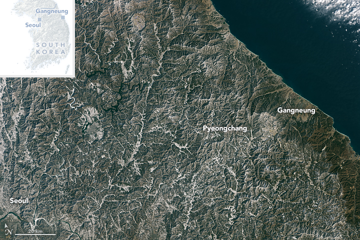
While all of the skiing and snowboarding events (as well as the opening ceremonies) will be held in Pyeongchang, Olympic ice events like hockey, speed skating, curling, and figure skating will be held in Gangneung. The natural-color image below, acquired by NASA’s LANDSAT 8 satellite on Jan 26, 2018, shows both the cities:
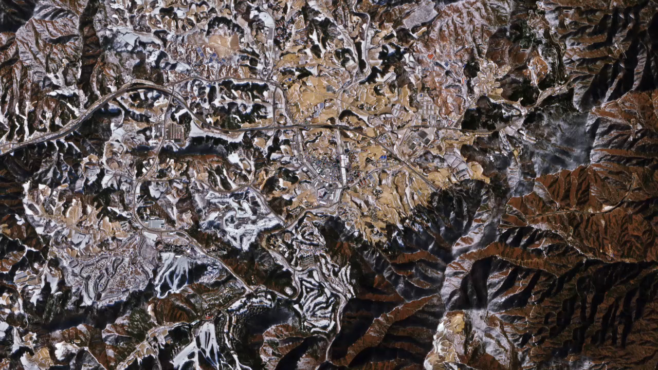
The image below was captured by ESA’s Copernicus Sentinel-2 mission on Jan 30, 2018. It shows the stunning view of the topography of the city of Pyeongchang:
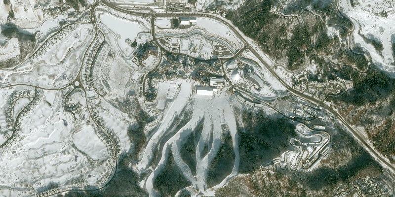
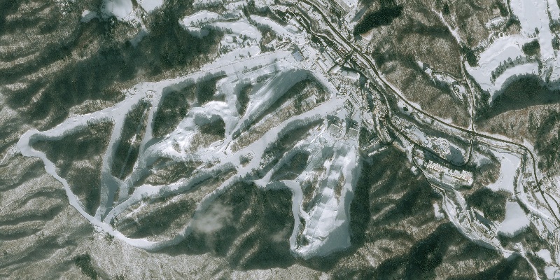
An Airbus Pléiades satellite caught the following four images immediately after the first snowfall in Pyeongchang in December 2017. Here you can see the sports facilities of the Alpensia Resort which are hosting Nordic, alpine and ice sports events:
Below, the Jeongseon Alpine Centre is organizing the Super-G and combined events. An altitude drop of more than 800 meters is required for downhill ski events, over a length of 3.5 km. Check it out:
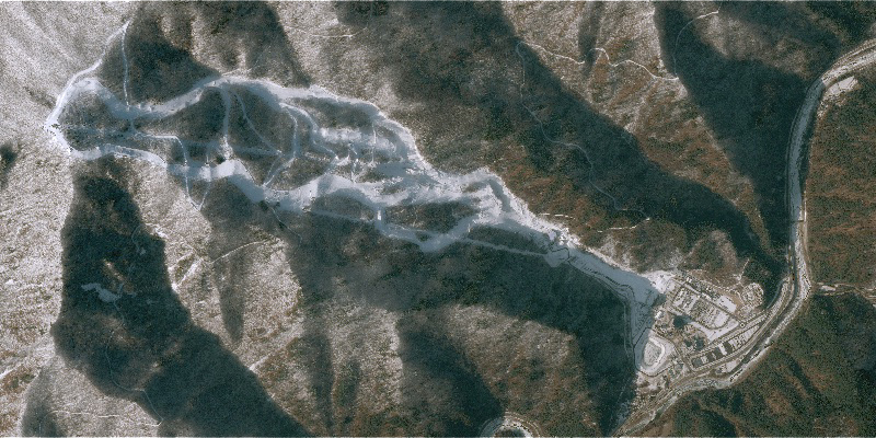
In the following image, you can marvel at the slopes of Bokwang Phoenix Park, one of the ski resorts closest to the South Korean capital of Seoul. Bokwang Phoenix Park is playing host to the freestyle skiing and snowboard competitions:
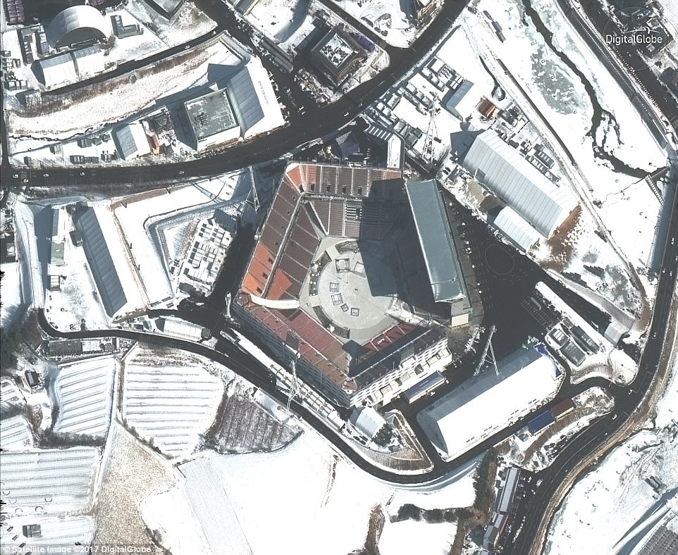
The image below was captured by DigitalGlobe’s WorldView-3 satellite. It shows the stadium where the opening ceremony was held. Since the stadium was built without a roof, the organizers had to bring in several measures to keep the spectators and athletes warm:
But for now, it’s Chill-1, Humans-0.

#Business


Next article
In a few weeks from now, the South African tourist hub of Cape Town will be forced to shut down most of its water taps. According to the latest statement by the mayor’s office, Day Zero will arrive by mid-May 2018. And once Day Zero hits, Cape Town residents will be forced to start queuing for water at one of the 200 ration points designated across the city.
Even now, water rations have been capped at 50 liters per person per day. Citizens are being urged to map their water-saving efforts and help stretch out the dwindling supplies. The government is pulling out all the stops to ensure that the water supplies don’t run out before the arrival of winter rainfall – although, its quantity or even the date of arrival cannot be predicted accurately.
This is because South Africa has been witnessing an unprecedented drought situation since the last three years. Some researchers are even calling this dry spell ‘the draught of the century’.
While climate change scientists are saying that unexpected draughts like this are going to become commonplace in the near future, city planners blame poor water supply management in Cape Town for the predicament. The government, meanwhile, is comparing this exigency to World War II and 9/11 attacks, fearing that water shortage might lead to the breakdown of the social order.
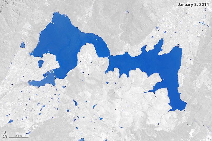
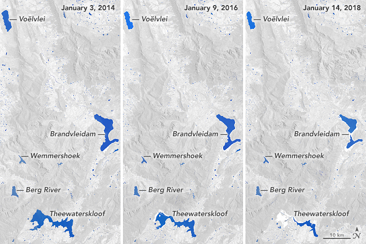
Satellite imagery has unmasked Cape Town’s water crisis from above, showing how dramatically the water reservoirs of the city have depleted over the last few years. The Theewaterskloof Reservoir, which supplies water to nearly half of Cape Town, has diminished dangerously between January 2014 and January 2018.
The animated image supplied by NASA’s Earth Observatory below shows the reservoir dropping from its near full capacity in 2014 to below 13% last month.
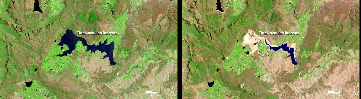
You can see a side-by-side comparison of the Theewaterskloof Reservoir’s transformation in a satellite image provided by the USGS below:
This following trio of images shows how the three successive dry years have taken a toll on the water system of the second-largest city in South Africa:
As Cape Town Mayor Patricia de Lille says, “We can no longer ask people to stop wasting water. We must force them. We have reached the point of no return.” And there’s a lesson for other cities around the world to learn from that.