Visualize above-ground and under-ground utilities with Esri’s new 3D Basemaps solution

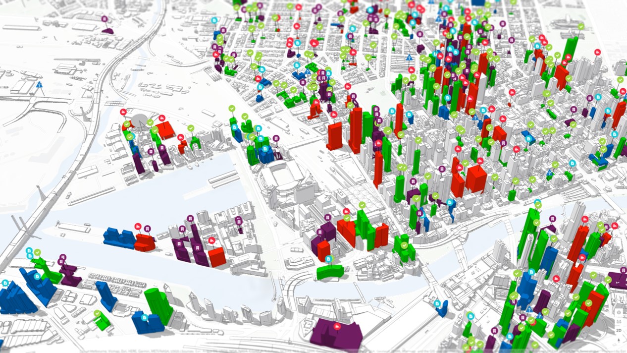
Esri has released a new ArcGIS solution that leverages an organization’s existing data (LiDAR, building footprints, underground utilities, etc.) to streamline the creation and maintenance of a 3D basemap for the community. The output of the 3D Basemaps solution is a collection of 3D layers that GIS analysts can leverage as a 3D basemap for desktop, mobile, and web mapping applications.
The importance of 3D visualization and analysis in urban environments is growing rapidly for both utility companies and government organizations at all levels. With the ability to view the community in 3D becoming imperative for sustainable planning and community engagement alike, it is now accepted that 3D map resources provide stakeholders with a better understanding of what is happening where, allowing for a faster and more engaged decision-making process.
However, many organizations across the world are still struggling to create and maintain 3D basemaps that can foster the adoption of 3D visualizations for a wide range of use cases such as urban planning, emergency management, and real estate.
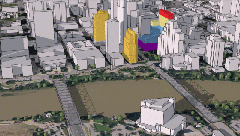
City-wide project visualization in ArcGIS Urban using a 3D basemap
Esri’s new 3D Basemaps solution can help these organizations to create, maintain, and share 3D basemaps at various level of details, including:
- Elevation: A detailed ground elevation layer can be automatically generated from the input LiDAR data.
- Buildings: Buildings with simple roof structures can be generated automatically from the LiDAR. Attributes such as building height and roof form are extracted from the LiDAR and added to the building footprints.
- Floors: Buildings can be split into floors using attributes such as floor height and number of floors or according to space use type.
- Trees: Tree location and size can be extracted from ground classified LiDAR as point features.
- Bridges: If bridge surfaces are classified in the LiDAR and the LiDAR is dense enough, it is possible to extract the bridge surfaces as 3D polygons.
- Powerlines: You can use your existing GIS data to visualize distribution and transmission lines in 3D. A wide variety of conductor and tower configurations are supported.
- Underground pipes: By leveraging elevation attributes, you can also turn your existing 2D underground utility features into 3D features from existing GIS data.
Esri says that this new release is a major enhancement of the existing local government 3D basemaps solution which has been moved to mature support.

#Business


Next article

Great Britain’s national mapping agency Ordnance Survey (OS) has launched a new geospatial data platform to allow users to download open data products easily and get quick access to OS premium data via APIs.
Replacing the current OS online ordering systems (OS OpenData Portal, OS Orders, and API shop), the new OS Data Hub will also provide users with free access, up to a monthly threshold, to OS MasterMap – one of the most detailed location datasets in the world.
Additionally, the APIs will also give users up to £1,000 per month of free access to a range of other premium datasets including the iconic 1:25,000 leisure mapping and road network data.
Access to OS OpenData products remains free and without any cap. Four new OS OpenData products have also been released, including the Unique Property Reference Number (UPRN), Unique Street Reference Number (USRN), and TOIDs with associated geometry.
The free APIs available via the OS Data Hub include:
- OS Maps API: To allow easy integrations of OS mapping into apps and websites, including OS MasterMap Topography Layer and 1:25 000 Scale Colour Raster.
- OS Vector Tile API: To enable designers and developers to create slick, quick vector maps that are fully customizable.
- OS Features API: To provide direct access to OS MasterMap data for data analysis. There are many data layers available, which users can filter and select based on location or attribution, such as buildings, roads, and greenspaces.
- OS Downloads API: To allow users to download OS OpenData products direct to their machines.
- OS Names API: An accurate location look-up service including place names, postcodes, roads, and more.
- OS Linked Identifiers API: To provide access to the valuable relationships between properties, streets, and OS MasterMap features.
OS believes the new pricing structure will benefit current OS customers and partners by reducing royalties by up to 80% for the offline use of data, including valuable property level address data.
Steve Blair, CEO of Ordnance Survey, says that these new services, datasets, and changes to licensing are only the beginning for the OS. “We have an ambitious plan, working in collaboration with the Geospatial Commission and expert user groups, to bring improvements and new developments that will show customers how to see a better place and deliver positive impact,” Blair says.