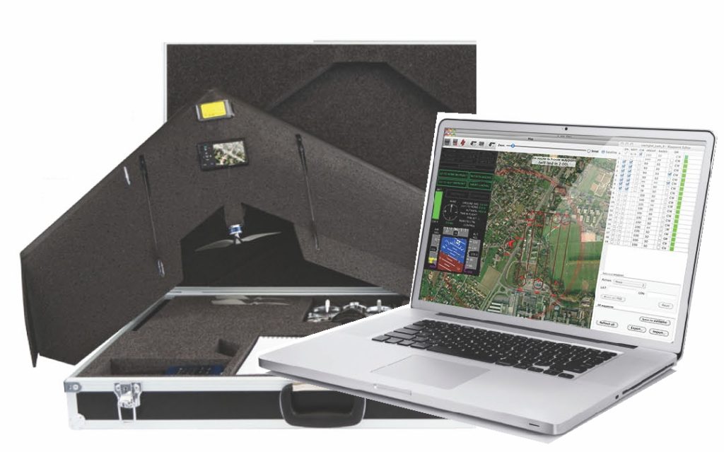

 Unmanned Aerial Vehicles have a special place in my list of awesome stuff in the world. The long hours in the hot Indian sun, trying to get the total station to work and take measurements is certainly something that I did not enjoy as a geomatics student in India. A couple of years later, as a GNSS engineer I saw the most awesome gadget in geomatics – the UAV that can replace all the hard work in the field for the surveyor. You have to agree that a small glider that can help prepare maps with few cm resolution, whenever you want and at a fraction of the cost of a real photogrammetry mission is certainly awesome.
The UAVs have been revolutionizing the world of photogrammetry and surveying in an unprecedented fashion. UAVs have allowed surveyors to complete surveys in less than few hours which traditionally would have taken somewhere around a few days. They made surveying possible in terrains that were hostile – forests, mountains, etc.
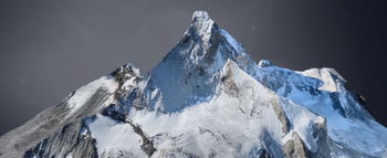 If Google Earth Street View made it possible to take a virtual tour of the most famous cities in the world, UAVs are going to change the way we looked at mountains 😉 Mapping the mountains to be GEOMATICALLY correct! SenseFly, a Swiss company has completed a historic mission by mapping the most famous mountain in the Alps – “The Matterhorn”.
I’ll let you witness the awesomeness before I go on raving about the achievement 😉 Oh and by the way, the 3D model has a resolution of 20 cms!!
Just a bit of trivia: In May 2011 researchers from the DLR (Deutsche Zentrum für Luft- und Raumfahrt) created a 3D model of the Matterhorn with a maximum resolution of 50 cm using optical satellite data, in cooperation with DigitalGlobe and 3D Reality Maps.The fact that is now possible to produce 2D and 3D models with a resolution of 20 cms even in the most daunting of terrains using the UAV technology makes this flight by the SenseFly team a historic event.
UAV in mapping = awesomeness 🙂
So what you think? Is the future of mapping headed the UAV way or what? Let us know!
Source: Direction Magazine


#


Next article

So everytime I want to learn something new, I think of taking a new class and pay hundreds of dollars. At the end when I realize that course wasn’t really what I wanted to learn, I either regret my life or simply quit. What if we can learn a ton of stuff from wonderful places just for nothing?! So here is a good list of geo-related courses, all free of cost with an added advantage: More colors on your resume!

Several GIS related courses, from introduction to Python scripting , 3D modeling to web mapping , are offered free of cost. Some advanced courses needs some $$, but for starters, this is a great place to be! Upon completion of each of these courses, one can get a free Professional Certification!! A compiled list of free classes can be found here.
What’s better than learning from the pros? And when you receive a certificate from them, that’s going to be really good!
2. Harvard GIS
4. Stanford GIS
5. Penn State – GIS
6. TU Delft – GIS for Crisis Management
It gets better if you are an EU/EEA Citizen! You can get a free MASTER’s degree in GIS!!
Tired of ArcGIS and want to learn something thats cheaper to use? Fantastic, there are gazillion opportunities to do that!
9. GRASS GIS
And if you are someone looking more into emergency management related classes, FEMA offers a ton of independent study program
Want to freshen up some basic concepts in Remote Sensing?
11. Integrated Geospatial Education
12. PENN State – Remote Sensing
14. Tutorials on Remote Sensing
Looking for GPS related courses?
15. GPS Training
Lets learn more now! Please feel free to add more to this list to make it more comprehensive!