
Have you ever heard of Unmanned Aerial Vehicle (UAV), commonly known as drones, and its applications in mapping industry? Of course, this question might be irrelevant and you might have already come across various UAVs in the recent couple of years which are now trending in various fields. There are UAVs which can map mountains, which are being used as Tacocoptors and also used for film making etc.
Last week, I have attended India Geospatial Forum at Hyderabad, India and I have come across a lot more new technologies and exchange of ideas at the forum. It was pleasure to attend various technical sessions and demos of various products which made my presence at IGF more memorable.
One among most innovative technologies and an eye catcher in throughout event is AIBOT X6, a drone from Aibotix. Its applications are spread across small scale aerial imaging, mapping and industrial inspections.
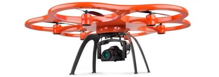
But, I was curious to know what is so special about this UAV when compared to the existing UAVs in GIS market and how it can change the face of GIS aerial mapping for micro scale projects. The fact is, it supports fully automatic and programmatic take-off, flight paths and landing home with real time monitoring during flight with intuitive steering via tablet PC.
Meaning, design your aerial flights using its software or any other software and feed that information to the UAV, mount a Digital SLR (georeferenced) on UAV and then you only need to just click the start button on tablet PC and at the end of the flight, UAV will be at the place where it took off. On other hand, it has got standardized interface for new sensors like RTK GNSS transmitter, Thermal Imager, multispectral cameras, 7-Gas detector and LiDAR 3D laser scanner ect. The application possibilities are almost endless.
I believe, this video can demonstrate it in a better way and here are more demo videos.
Wowwww !!! Isn’t it so amazing to accomplish your aerial mapping project as simple as I said? What’s in your mind? Would UAVs change the face of Aerial mapping for small scale projects?
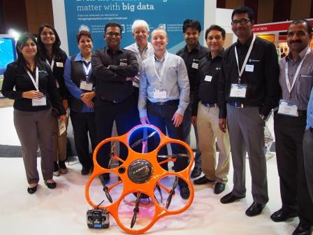
Here is the team behind the show !!!


#Business


Next article

The fascination for Lord of the Rings among cartographers and geo-visualization geeks is a phenomenon that is simply beyond analysis. I cannot recollect any other Novel getting the same attention as JRR Tolkien’s “Lord of the Rings”. JRR Tolkien would have hardly imagined that his work would become the “The Lord of all Mapping Projects” as well 🙂
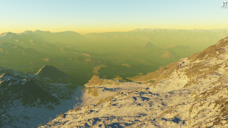
There have been numerous maps and visualizations of Middle-Earth, the most famous among them – Google’s Middle-Earth visualization, which was more about exploring individual places on Middle-Earth and of course, the games! Now it is time for Outerra, a 3D planetary engine to bring to life the world of Middle Earth using data from the Middle-Earth DEM Project . Here’s a glimpse of how detailed the DEM of Middle-Earth looks like.
Here’s the link to the Outerra Forum with instructions on how to download and install the Outerra 3D Engine to render the DEM of Middle-Earth. The Middle Earth Digital Elevation Model by Outerra may not be as interesting as Google’s project but it is amazing to note how many geo-visualizations come up year after year for Middle-Earth and Lord of the Rings. I’m darn sure that we’ll feature more geoawesome projects that visualize the “Middle-Earth”!