
Eric Fischer from Mapbox has been working on a number of cool geo visualization projects over last years. This time he created something really unique.
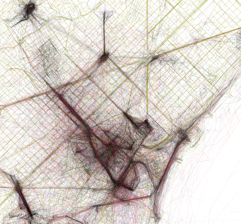
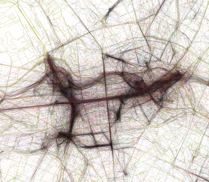
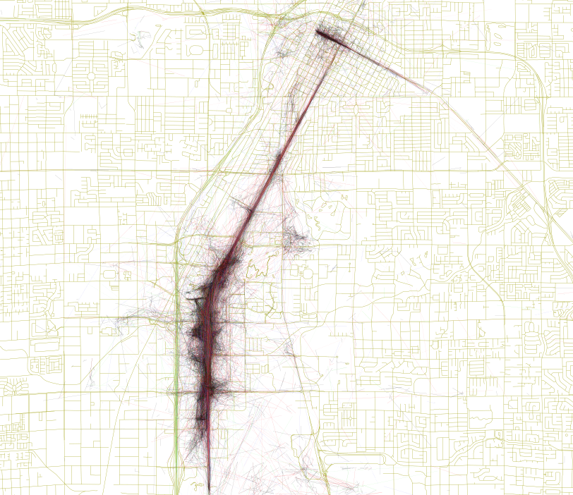
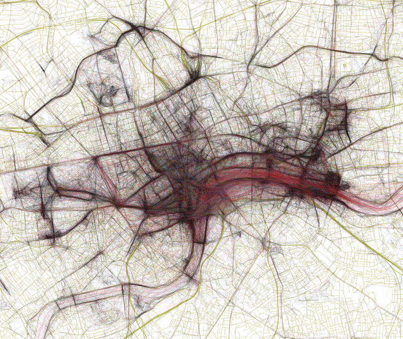
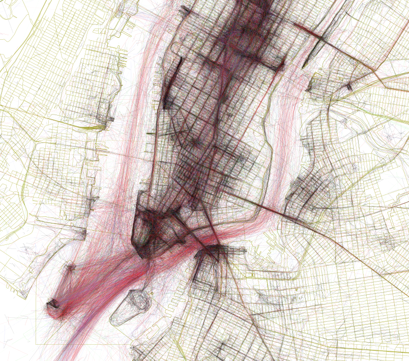
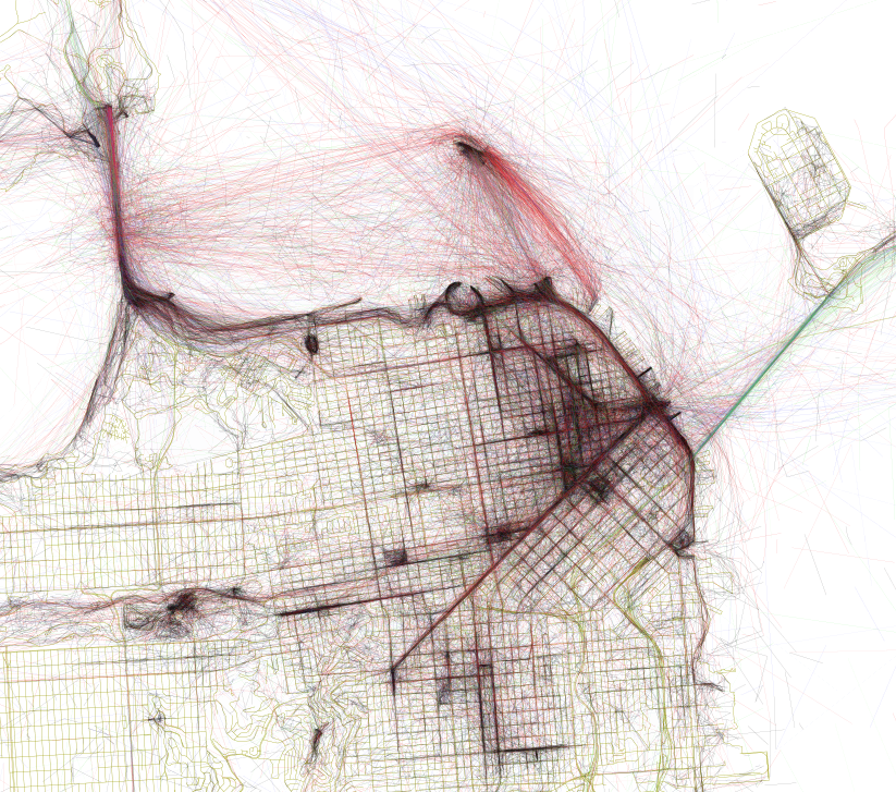
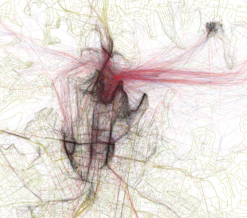
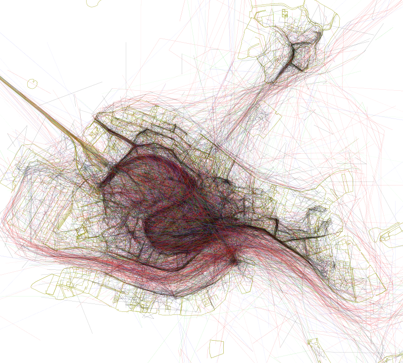
His latest project called ‘Geotaggers World Atlas’ aims to discover the world’s most interesting places by visualizing spatial layer of Flickr photos. Using Flickr’s API, Fischer has analyzed meta data of all geotagged photos from the last 10 years. Than he linked the dots between subsequent photos taken by each photographer. The cluster of paths of thousands of individuals created a beautiful sketch of urban spaces. But Fischer wanted to go further. He analyzed a time between two subsequent photos to calculate a speed of a photographer’s jurney. Each black line indicates a walking journey and red lines show speeds between 11 and 30km/h (7 and 19 mph). With this selection of speeds Fischer wanted to identify favourite bike routes but unsurprisingly most of this lines show images taken from ferries.
Fischer explained on his blog:
A cluster of geotagged photos is a good indicator of the interestingness of a place because it signifies that people went there in the first place, saw something worth taking a picture of, and put the extra effort into posting it online for others to appreciate.
The effect is amazing. Check it out:
Barcelona
Berlin
Las Vegas
London
New York
San Francisco
Sydney
Venice

#Business

Next article

The Internet of Things and Industry 4.0 are currently top of the list for both the digital economy and traditional industrial sectors. Indeed, localisation technology has become essential for either of these realms. In an interconnected world, constant and reliable localisation is crucial to the communications taking place among countless “things”. Satellite navigation is thus also an integral component of these forward-thinking areas.
The winners in 30 categories will be award prizes in a festive Awards Ceremony in autumn 2015
Each year, the European Satellite Navigation Competition (ESNC) recognises the best products, services, and innovations that leverage satellite navigation in our daily lives.
“Satellite navigation is an essential element of modern mobility and a key technology in particular, in the age of a data-driven economy. This is exactly where the European Satellite Navigation Competition (ESNC) comes in. It provides a public platform to the creative community in order to help promising ideas turn into solutions that are commercially mature and generate added value for society. ” affirms Alexander Dobrindt, Germany’s Federal Minister of Transport and Digital Infrastructure (BMVI).” I was delighted to once again assume the patronage of the ESNC this year and I am glad that I can now play my part in continuing its success story.
In addition to taking home prizes worth a total of EUR 1 million, this year’s winners will become part of the world’s leading innovation network in global satellite navigation systems (GNSS). In addition to cash prizes, winners of the 30 prize categories in the ESNC 2015 profit primarily from the assistance they receive in implementing their business models. A jury of international research and industry experts will then select the year’s overall champion from among the winners of these categories, which comes with an additional EUR 20,000 and access to a six-month incubation programme in the champion’s preferred region.
“Those who enter the ESNC benefit in particular from our global network, which provides them with tailored support in developing their business concepts and bringing them to market,” explains Thorsten Rudolph, managing director of Anwendungszentrum GmbH Oberpfaffenhofen.
Meanwhile, ESNC entrants particularly benefit from the chance to work closely with worldclass institutional and regional partners. The competition is geared toward individuals and teams from companies, research institutes, and universities across the globe. Those interested can participate from 1 April to 30 June 2015 at www.esnc.eu. “As the Galileo satellite constellation continues to expand, efforts to promote corresponding applications will become increasingly important. This is where the ESNC is already playing a key role,” points out Matthias Petschke, the European Commission’s director of satellite navigation programmes. “As such, the Commission is definitely looking forward to seeing the creative and innovative GNSS-based applications submitted this year.”
ESNC 2015 participants can choose from more than 20 participating regions that stand ready to help them make their business ideas a reality. They also have the option of entering their ideas for one of the special topic prizes on offer, which will increase their chances of being named the overall champion. This year’s special topic prizes are being sponsored by: the European GNSS Agency (GSA), the European Space Agency (ESA), the German Aerospace Center (DLR), and the Ministry of Transport and Digital Infrastructure (BMVI) in cooperation with the German Federal Ministry for Economic Affairs and Energy (BMWi). In addition, entrants are welcome to submit prototypes to the GNSS Living Lab Challenge, while the University Challenge specifically addresses students and research assistants.
All of the information on this year’s prizes, partners, and terms of participation is available at the ESNC website, www.esnc.eu.
Joint international Kick-off event for the ESNC and Copernicus Masters on 21 April 2015 at the House of Commons in London

International kickoff scheduled for 21 April at the House of Commons in London
For the very first time, the starting signal for these two leading innovation competitions in satellite navigation and Earth observation is to be sounded at a combined kickoff event. This gathering, which is scheduled to take place on 21 April from 5:00 to 8:00 p.m. at the House of Commons in London, is expected to draw high-ranking representatives from both of the networks involved, including from the European Commission, ESA, GSA, BMVI, Airbus Defence & Space, T-Systems, Innovate UK, and SA Catapult (more information on programme). Meanwhile, numerous other national kickoff events will be taking place across Europe in April and May.
Anwendungszentrum GmbH Oberpfaffenhofen – an experienced organiser
Anwendungszentrum GmbH Oberpfaffenhofen (AZO) has been organising the ESNC in close cooperation with an international network of research, industry, and regional entities since 2004. By leveraging its extensive experience as a specialist in building and maintaining global innovation networks and organising related competitions, AZO supports product innovations and the creation of new companies, particularly in the field of commercial aerospace applications. www.anwendungszentrum.de