
One of the earth’s most alien landmasses, the Antarctic’s rocky surface, concealed by a vertical ice crust of up to more than 3km (average thickness 1,6km), was unveiled, at least digitally, at an unprecedented detail in spring 2013. Scientists have created a significantly improved map of the continent’s bedrock in the frame of the bedmap2 project led by the British Antarctic Survey. While the previous version ‘bedmap’, produced in 2001, gave a general overview of the Antarctic’s topography, the high spatial resolution of bedmap2 shows a landscape of mountain ranges, hills and vast plateaus dissected by canyons and gorges. Thus, it conveys the cartography of the bedrock terrain much closer to reality than ever portrayed. The project was prompted by the motivation to calculate the total extension and mass of ice that occurs in the Antarctic, which is essential to estimate the sea level rise induced by the melting of the polar ice. Therefore, the shape and structure of bedrock beneath the ice sheet was needed to know in detail. Bedmap2 relies on information from NASA’s IceSAT1 satellite (Cloud and Land Elevation Satellite) gathered between 2003 and 2009 and ice thickness data from the airborne based Operation IceBridge (radio echo sounding measurements, seismic techniques as well as satellite and cartographic data).
The new level of measurements delivers important information on variables that are of interest for research, particularly climate related study due to the key role of the Antarctic in this matter. Some new facts are:
- The volume of Antartic ice is 4,6% higher than previously assumed (27 million km³)
- Similar to previous estimates the melting of Antarctic ice shield would cause a 58m rise of sea level
- The mean depth of the bed beneath the grounded ice sheet is 72 m deeper than thought to date
- The ice sheet grounded on bed below sea level is increased by 10 % (which means that a considerable greater extent of bedrock extends below sea surface in bedmap2)
- The Bedmap 2 survey returned more accurate data on the lowest point on the Earth’s crust, which extends below the Byrd Glacier in Victoria Land at around 2,870 metres below sea level (around 400 metres lower than was previously thought).
The full survey of Antarctica via Bedmap2 is available for free via The Cryosphere, an open-access journal of the European Geosciences Union.
British Antarctic Survey – bedmap2

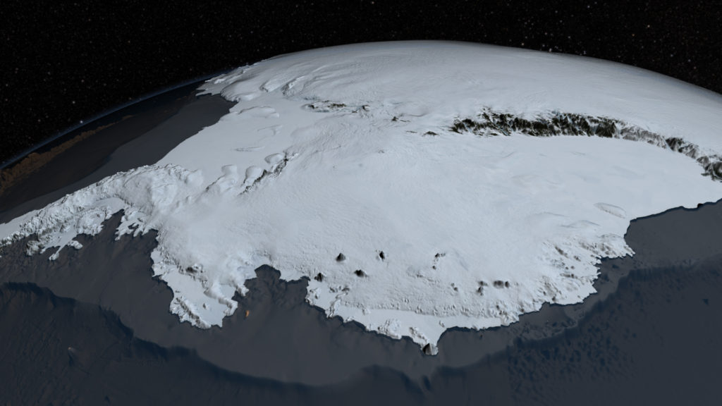
Image showing the Antarctic’ surface with the ice sheet as seen from space
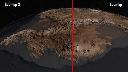
The image shows the differences between the most recent map of Antarctic’s rocky surface bedmap2 (left) and its previous version bedmap (right) from 2001. The topography in bedmap2 reveals much more detail than in bedmap.

#


Next article

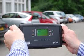
Can’t hide any more. GPS Jammer Locator and Detector! Image: Chronos Technology
The most infamous GPS jamming event in history of GPS has to be the San Diego Airport disruption. A Single event brought the flight control room in the San Diego airport to its feet, wondering and panicking to as to what was really going on. ATM machines refused customers , the Harbor traffic management system was going haywire. All this because of a GPS jamming event. A clear indication that the GPS system does not just run your Sat Nav on the car, it does a lot more than that.
GPS is in a sense, is a silent force that powers the modern communication world. Mobile network service providers use GPS time signals to coordinate how your phone talks to the cell phone towers. Electricity grids turn to GPS for synchronization when they are connected together. Banks and stock exchanges use the GPS/GNSS for time-stamping transactions without which commerce would be rendered impossible.
The GPS Jamming was eventually identified after 3 days of investigation – a navy exercise to test procedures when communication was down. The Technies had also jammed GPS signals unintentionally. Unfortunately, the jamming expertise was not just localized or available to the Navy or the Military. There was another infamous event where a truck driver was using a GPS jammer near an airport to avoid being tracked! The GPS jamming device is available for under 30$ online but it’s illegal to use/buy such a device only in a few countries. Many across the world have not yet realized the danger and disruptions that these devices can cause.
So isn’t there anything that can be done to find the Jammers?
Actually, until now it was possible to find the presence of a GPS jammer but was not possible to locate it. Enter Chronos! The company claims that its £1600 GPS Jammer Detector and Locator System can identify a jammer-using vehicle in a multi-storey car park – and can pinpoint portable devices in drivers’ pockets when they have left their cars. Pretty impressive! Of course, they didnt explain how the system works but some people have guessed that it has to be a signal triangulation of some sort. But sadly, it only works for L1 signals. I suppose they are working on getting L2 signals covered as well. Hope so!
Detect and Locate GPS Jammers – No more hiding!