
Data, data everywhere but not a byte is used! GIS analysis can be a powerful driver for Business intelligence but how often it is utilised? Regardless of the accuracy of the numbers in the tweet below, Javier (CEO of CartoDB) has a point here. Organisations are either not making use of location data or in some cases, they end up not making best use of (their) location data. (Related: Can Twitter do more with its location data).
80% of data has a location component, but only 10% of organizations are making use of it – @jatorre, @cartodb #datadrivennyc
— katie yo (@_katie_yo) February 16, 2016
Data, data everywhere but not a byte is used!
One of the biggest challenges for any technology is to move beyond the early adopters and attract the masses. Until Google maps came around, using a map for directions meant you needed to know how to read the map. Look at where we are now!
Location tech is still very niche and not always well understood. GIS software are notoriously famous for being difficult to navigate and being CPU resource hoggers. They are definitely getting better and more accessible but (basic) GIS analyses are not yet as simple as getting answers on Google. Why should running an GIS analysis to get the coverage area of a fast-food chain outlet be any more difficult than using a “Near me” feature on your smartphone?
Why should running an GIS analysis to get the coverage area of a fast-food chain outlet be any more difficult than using a “Near me” feature on your smartphone?
The next biggest revolution in Location tech is not just about adding (more) cool features but its more about getting it to the masses.
Geotrends 2016 – What to expect across Geoindustries this year?
Taking Location tech to the masses
There are a lot of factors that enable a particular technology to go mainstream and reach the masses. Ease of use is definitely one of the biggest factors. Smartphones existed well before the iPhone came on the scene but the iPhone gets the credit for taking the tech to the masses. Yes, I do agree that it’s comparing Apples ( 😉 ) and oranges but for location tech to go mainstream it needs to be simple to use.
Visualising your data on a map shouldn’t require one to be a computer science expert and that’s why when CartoDB launched it’s one-click mapping tool, even tech blogs such as TechCrunch took to the web to write about it or for that matter, the WIRED article about Mapbox studio. Location tech is certainly gaining traction with Tech blogs (Read: Locate this! The battle for app specific maps).
Location intelligence for the web
Motion Intelligence, the company behind the Route 360°-technology certainly shares in my rumbling earlier about making (basic) GIS analysis simpler to use. They came up with a really nice simple solution for location intelligence analysis. For e.g. if you need to know how many customers can reach your new McDonald’s (or Burger King) outlet within a given travel time, one can visualise that by simply adding an address to a web map. No kidding!!
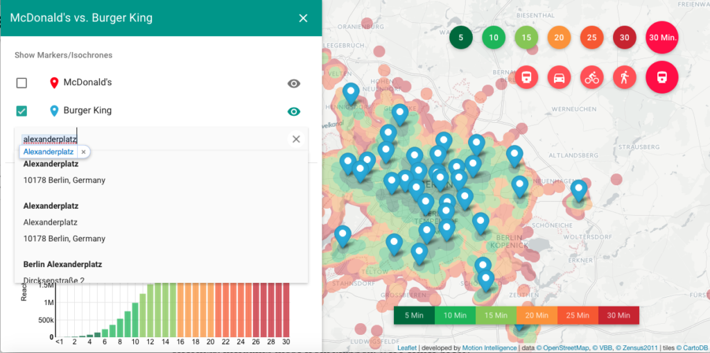
Making location intelligence dead simple – Motion Intelligence
Of course, one could argue that such analysis however fancy they look but may not really be useful as business intelligence. Yes, perhaps that true but I’m sure that will change very soon.
Location tech is at a stage where (digital) maps were before Google maps existed. Its very powerful but still only a small percentage of the world uses it. But all that is changing and changing fast!


#Business


Next article

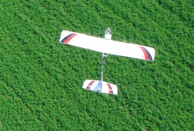 In farming, this principle is vital. The illustration below shows how a visual sensor on PrecisionHawk’s UAV platform can identify pests, like weeds, from the air at crucial points in the growing season. During the early stages just after seeding, farmers have to make decisions about their weed control. With the ability to determine, from an aerial view, exactly where the weeds lie, a farmer can perform specific spot applications to the affected area saving time and money.
Weed detection is carried out by determining the height or profile of anomalies across plots. Crops are generally of uniform heights, so sudden dips or peaks in the profile denote the potential presence of weeds.
The picture above shows a 3D rendered image of a plot in question. The red line points out the part of the plot that is being analyzed. The profile of that line is displayed in the bottom left image. As you can see, there is a sudden gap and peak in the profile. This anomaly indicates the presence of weeds. The only way to spot weeds is to visually inspect if they are present. For farmers who own large fields, this is time consuming–and time is an expensive commodity. The use of a UAV allows for the quick and frequent visualization of fields and consequent analysis through anomaly detection to immediately identify areas where weeds are prevalent. This addresses the problem by (1) immediately identifying weeded areas and (2) allowing the farmer to act in a targeted manner.
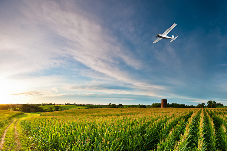
Today, UAVs cannot completely eliminate field scouting, but the ability to monitor specific areas and visit geo-referenced plots across many acres is invaluable. However, we do envision a time when UAVs will replace field scouting entirely and humans will never even see collected data. The data will run from the UAV into the tractor for spot application at the problem areas across a field. It’s the future. Decrease time and inputs and increase efficiency to enhance outputs.
What actions are farmers currently taking to resolve the existing problem around weeds?
There are approximately 8,000 species of weeds and most of them affect the farming industry. They reduce crop yield by competing for water, light, soil nutrients, and space. Other problems associated with weeds in agriculture include: reduced crop quality by contaminating the commodity; interference with harvest; serve as hosts for crop diseases or provide shelter for insects to overwinter; and production of chemical substances which are toxic to crop plants, animals, or humans.
Weeds are common on all 485 million acres of U.S. cropland and almost one billion acres of range and pasture. Due to the commonality, people generally do not understand their economic impact on crop losses and control costs. In estimation, U.S. farmers annually spend $3.6 billion on chemical weed control and $2.6 billion for cultural and other methods of control.
UAV platforms carrying remote sensing technology such as can cost-effectively and efficiently solve many basic agricultural problems, like weed control. These technology tools support better decision-making allowing a user to identify problems while they are still manageable and before they get out of control.
UAVs are now widely being used across farms globally. Coming to a farm near you.