
 Volunteered Geographic Information (GI) or Crowd Sourcing of data has been buzzing around us quite a lot actually! Global Warming?? Well thats been buzzing around even longer!
Why not combine them both and see if that can lead somewhere! Probably this is what UNESCO and European Environmental Agency must have thought. It makes a lot of sense considering that you want Individuals to be aware of the need for sustainable practices, I mean its a great idea to get us “Citizens” involved in a million dollar research project that helps sustain the planets eco-system in a way thats new and appealing.
CObWeb or Citizens Observatory Web project!
Crowd Sourcing may have been the backbone for loads of Geospatial applications and Apps that have been in the domain for a while. However the science community has by large regarded crowd sourcing as not a “scientific” way of data collection and tended to view it with an attitude that made it i.e. Crowd Sourced data something to be the equivalent of Mass Market science. In that sense, it is refreshing and heartening to hear that about the Citizens Observatory Web project or CObWeb as they i.e. The European Environmental Agency and UNESCO like to call it, uses Volunteered Geoinformation that is crowd sourced as a vital and fundamental to the science and conservation project.
The UNESCO Dyfi Biosphere reserve, covering parts of Ceredigion, Gwynedd and Powys in Wales will be the first in a series of biosphere reserves that will benefit from crowd sourced data. The project envisions Individuals as Scientific data pools and their smartphones to be the tools of scientific data. Sometime in the near future ( Estimated time of an year actually) you can take pictures of floods with GPS coordinates and submit it so that the scientific community can help policy makers and Governments be better prepared and make informed decisions. Not only that, they are also envisioning ways to utilize smartphones and individuals to be able to collect biological observations and measurements.
Hmm, I wonder “Biological Observations”!! Maybe take pictures of wilting crop or maybe even diseased plants in the biosphere reserve? Actually they plan to collect data on species distribution, land cover/use and more environmental variables. Its a £7m project and they are actively developing Phone Apps at the moment so I am hopeful of interesting things. Let me know if you get any interesting ideas yourself!
The “science guys” want to utilize Citizen power to collect data that can help with their research and at the same time giving the feel of being active citizens in such bio conservation projects.
To put it in the words of Prof. Jacqueline McGlade, Executive Director, European Environment Agency “It is no longer sufficient to develop passive lists or reports to ‘inform’ citizens of changes in our environment. We need to engage with citizens and ask how they can ‘inform’ us”
Welcome to the ERA OF CROWD SOURCING! Welcome to the ERA OF CITIZEN SENSORS!
Source: BBC, European Environmental Agency
http://www.bbc.co.uk/news/uk-wales-mid-wales-20943078
http://www.eea.europa.eu/pressroom/speeches/global-citizen-observatory-the-role-of-individuals-in-observing-and-understanding-our-changing-world


#Ideas


Next article
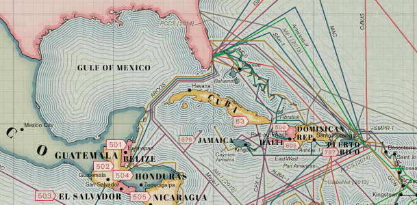
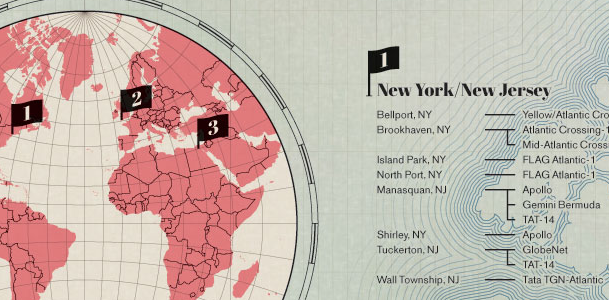
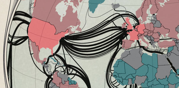
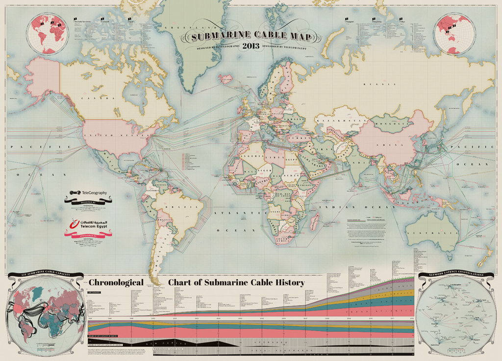 TeleGeography released a 2013 version of its Submarine Cable Map which shows routes of 232 in-service and 12 planned undersea telecommunication cables… and it’s pretty awesome. You can buy a printed version or you can have a look at the interactive one. The maps do not denote capacity, but it shows an interesting connections around the world, which are usually difficult to see.
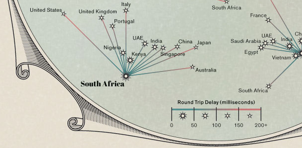
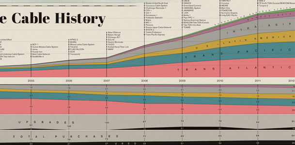
From the cartographic point of view the map is simply beautiful. The design was clearly inspired by antique maps but there is as well ‘network latency constellations’ part which brings to mind star charts, made by astronomers centuries ago.
It almost a masterpiece, have a look at the graphical details:
 source: Submarine Cable Map