
2018 has barely begun and the mapping community has already been smacked with what would be one of the saddest news of the year. Open-source pioneer Mapzen is shutting down. Come February 1, 2018, and the four-year-old platform will pull the plug on all of its hosted APIs and support services.
This is what we found on the Mapzen blog:
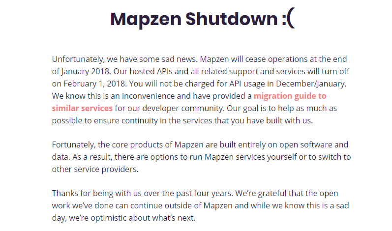
Though Mapzen didn’t give any explanation for why it is closing its doors, it has gently nudged the tens of thousands of its users toward the silver lining: Since the company’s code and data is open, users can make sure its legacy lives on by running their own servers with the open-source projects that powered Mapzen services. Alternatively, users can also switch to another hosted API that offers similar functionality.
To make this transition as smooth as possible, the model ‘open-source first’ company has put together a brilliant migration guide detailing how someone can use Mapzen’s open data, even with limited technical knowledge. Documentation for each product will be available in open-source GitHub repository.
The guide also serves as an excellent inventory of alternative open-source services and hosted APIs. And frankly, we would like to see more startups take this wonderful exit approach when they shut down, if not for the sake of the projects, but for the gratification of the people who have worked so hard to build them.
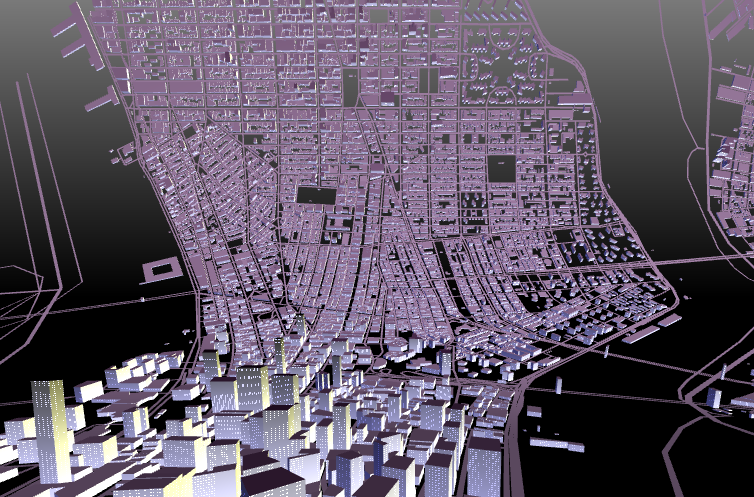
Mapzen’s extremely thoughtful and wildly inventive team found inspiring ways to visualize location data, churning out a perfect amalgamation of aesthetics, effectiveness, and historical continuity with each strikingly good-looking map. It’s really disappointing that they couldn’t find the investors to shore up their operations because we would have loved to see these guys keep making sustained, long-term improvements to our ecosystem.
RIP Mapzen. Thank you for being so awesome. Thank you for being so open.

#Business


Next article
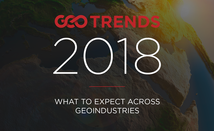 As GIS becomes all-pervasive with millions across the world using maps every day, the year ahead looks super exciting for the geospatial industry. While advancements in autonomous driving technologies, as well as virtual and augmented realities, are mandating that the maps of the future be more precise than ever, the data to fuel these maps are increasingly coming from the user community, and not just professional cartographers. Meanwhile, the professionals are also benefitting from the time-efficient and transparent approaches to surveying. So, what can the industry expect in 2018? Find out from the insiders!
2018: The Year of the Map
 Chris Campbell, Manager, HD Map Innovation Center at RMSI North America
In this New Year, here is a resolution the mapping industry should aim for — resolve to make 2018 the year the mapping world realized the opportunity to lead the development of maps for self-driving cars. We are finally at a point in the autonomous driving realm where maps are ‘what’s next’. Maps for autonomous driving (HD Maps) are more detailed and more complex than previous maps used for navigation. To be mapped extremely accurately (ideally below 10cm) these new maps require road, lane level geometry, and street furniture.
HD Maps are still in the developmental stages and are still being thought out; until now, a lot of the geospatial knowledge has been missing on the robotics side. But mapping companies are now in a unique position to be able to define what HD Maps are and how they fit into the autonomous driving ecosystem. In the year ahead, look for the mapping industry to take the lead in mapping for autonomous vehicles.
Mapping the Future
 Peter A. Weenink, Cartography Trendwatcher and Geo-Database Owner at Mapvision.eu
Is mapping only for the happy scientific and interested few? Believe me, there’s hardly any subject that’s not mappable in our world today and there will be much, much more to come if you are – in addition to the regular collection of geo-data – personally able to support. Coming from the antique survey and drawing methods, we now all know by now maps are made of highly-advanced survey, storage, and processing techniques, using and creating more and more data retrieved from your individual contribution to the enormous global databases.
Keeping the static maps for several purposes, the demands for extensive digital (interactive) maps, supplemented with statistics, real-time information and photographic visuals will grow progressively. With a big global variety of users in a growing demanding field, many of us will have the joy of providing geo-data collected with our own devices. The aid of Artificial Intelligence, algorithms and some out-of-the-box mapping, in the combination with strong GIS software, will provide us a fantastic map scenery which will last for us all for the next years!
Experts, Crowds, and Machines
 Christopher Beddow, Solutions Engineer at Mapillary
The future of maps is not a consistent vision. Some maps are global in scale, and yet their detail is fine-grained down to the neighborhood level. Other maps have no consideration for anything outside a small area of interest, like the bird habitat data in British Columbia. In each of these examples and many more, there is a place at the table for professionals, for citizens, and for machines. So, it is the collaboration between these different groups that will produce the maps of the future.
Collaborative platforms aren’t always public, as many enterprise platforms bring together professionals and internally used algorithms, while others augment user-generated data with machine analysis. At the root of these platforms is geospatial data, and it must all be collected, classified, validated, and verified. In the great modern assembly line of geospatial data production, we can all lend a hand to ensure that we all consume a better product. Whether you are a GIS professional, a computer vision scientist, a volunteer mapper, the owner of a mobile phone, or the operator of a vehicle, or even if you’re one of the machines themselves, you have a role to play.
(Read more about Beddow’s vision for the future of maps here)
Cadastral Surveying and Mapping
 Christiaan Lemmen, Senior Geodetic Advisor at Kadaster
I really believe that with today’s geospatial technology it is possible to collect the unrecorded geometry of boundaries for the billions of unrecognized land interests. And please remember that new approaches are also becoming apparent for the maintenance of collected data. Global standards such as the Land Administration Domain Model are already available in support of the data organization. And these ‘fit-for-purpose’ land administration approaches are cost-effective, time-efficient, transparent, scalable and participatory.
I think that in most cases it is sufficient to identify visual boundaries on imagery for boundary adjudication and mapping activities. Apps on mobile devices can be combined with imagery to identify plots, thus avoiding misinterpretation of visual boundaries on the image. Images can be available from satellites, traditional aircraft or drones. In cases of high land values or intensive land use, the field surveys can be conventional land surveys using high-precision total stations or GNSS. Finally, it is important to recognize that the organization of this process of initial data acquisition requires geospatial support in logistics and case management.
 Transportation Planning and GIS
Stewart Berry, VP of Product Management – Mapping Software at Caliper Corporation (Maptitude)
The Maptitude Team sees transportation as fundamental to all human activity. Business users want more advanced transportation tools, and so transportation planning and GIS software will increasingly merge in 2018, making the analysis of business and customer behavior much more realistic.
This is because routing tools help organizations improve their bottom line with companies saving extensive amounts of time and money with sophisticated optimizations such as right-hand turn only directions, and with companies such as Amazon, who need to efficiently manage vehicle fleets as competition heats up in areas such as same-day shopping and grocery delivery.
Using these vehicle routing tools, the government can provide more efficient services such as school bus routing, street cleaning, and snow plowing. While emergency services increasingly use the tools to make sure that they can reach everyone within a specified or mandated amount of time or distance along the road network.
What about you? What do you think this year has in store for maps? Share your thoughts in the comments below!