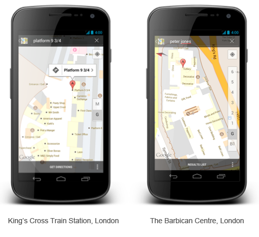
Google Maps has already almost 10,000 indoor venues mapped
 In 2011 the end of November 2011 Google launched their latest mapping baby – Indoor Maps. It was really cool project and it made all the competitors work harder. At the beginning Google launched indoor service with 60 locations in US and 50 in Japan. But what made it different from other indoor positioning and mapping services was that Google figured out that positioning technology is not the most important parts of that system. Even bigger problem is lack of maps. You don’t need your indoor position when you cannot reference it on the map.
Smart idea
Google solved that problem by inviting business owners to upload their floor plans into the Google Map Service and they’ve launched a special Android app to help business owners to calibrate their maps with Wi-Fi signals for the indoor positing. It was a very smart idea because half a year later IndoorLBS reports that Google has already almost 10 000 venues mapped and they are launching their service in Europe starting from several location in UK.
What it means?
I’ve been writing about it a lot of times already but let me highlight it one more time. Google Maps have totally changed the way how people think in a spatial way. It made people geographically aware. More and more users saw the value of adding the geographic layer two their everyday lives. Of course it sounds a little bit like simplification and banality but when you get deeper into it, its truth. Google, because of its scale has a unique power to make us used to its products in this way that maybe in couple of year you will not imagine searching for product in a supermarket. Google will tell you exactly where it is.
source: IndoorLBS, Google Lat-Long Blog


