
Geospatial jobs of the week – GIS Specialisten, K2 Geospatial, Development Seed, Vexel Imaging, and Geocortex are hiring

Are you enthusiastic about location data or anything geospatial, then this is the job portal for you! At Geoawesomeness, we’re working on creating an interactive job portal to connect companies to enthusiastic talent! By the way, we spontaneously post jobs on our LinkedIn throughout the week, so make sure to follow us there!
If your company is looking for new talent and you want to share the opportunity with our community, feel free to submit a job using the online form for us to review and include in our list!
Here are some of the jobs that are currently available:
Featured Job: GIS Developer at World Food Programme
📍Rome, Italy
The World Food Programme is hiring a GIS Developer! You will be responsible of maintaining and further improve a Web GIS platform implemented by the GIS team for the Logistics Cluster and provide support for the rollout of the GIS infrastructure in country offices and regional bureaux. Qualified female applicants and qualified applicants from developing countries are especially encouraged to apply. Want to find out more? More information here.
Featured Job: Senior Front-end Developer at urbanData Analytics
📍Madrid, Spain
UrbanData Analytics are the Global Real Estate Information & Analytics platform that will provide transparency to the Real Estate market and information to the citizens to take better decisions. Want to know more about them? Read our interview here.
If you enjoy the challenges of state-management in user interfaces using a Redux-like approach with RxJS streams, then this position is perfect for you! Apply here.
Featured Job: Full-stack Developer at urbanData Analytics
📍Madrid, Spain
urbanData Analytics’ stack and requirements are complex. In particular, their engineering team must combine specialists such as frontend, backend or data engineers with more flexible developers. Does that sound interesting to you? Apply for this exciting position here
University of Alberta: Geospatial Data Services Librarian, Digital
📍Edmonton, Canada
GIS Specialisten: Remote Sensing Analyst
📍Utrecht, Netherlands
K2 Geospatial: Full Stack Web Developer
📍Montreal, Canada
SWCA Environmental Consultants: GIS Specialist
📍Salt Lake City, UT USA
University of Twente: PhD Candidate Understanding Sustainable Urban Systems with Geospatial Data Analytics
📍Enschede, Netherlands
Pixxel: Lead AI Engineer
📍Bengaluru, India
Vexel Imaging: GIS Analyst
📍Graz, Austria
Development Seed: ML Engineer
📍Washington DC, USA
We have so many more jobs in our job portal, and couldn’t possibly fit them all in this blog. If you don’t see anything here for you, go to our job portal!
Are there any specific things you’d like to see in our job portal? Feel free to get in touch.
Want to get your dose of Jobs in Geo directly to your inbox? Subscribe to our jobs newsletter here.


#Featured


Next article
Note: this blog is not sponsored nor affliated with Coursera.
MOOCs (massive open online courses) are a great way to learn a new skill or keep up with the latest tech developments. Most of them are free or very low-cost, and can be done in the comfort of your own home. The advantage of Coursera is that they offer online education from some of the best universities and educational institutions. Some examples include IBM, University of Toronto, John Hopkins University, and Atlassian. While using Coursera is not free, it can be comparable to paying for certification for taking a free course on other platforms.
Why is this relevant?
First, it would only benefit you to continually learn new skills to bring new ideas to your workplace or to be competitive for the next job search, such as having a visible certificate on your LinkedIn. Second, as we have been building the Geospatial Job Portal, we have seen an increasingly diverse set of desired skills for those wanting to work in the geospatial industry; it’s much more than just being proficient in a specific software! As seen in another study, engineering has become more prominent and geography has been deemphasized. So even if you want have a passion for all things geospatial like we do, it would still be possible to expand your horizons and apply it to a geosaptial career!
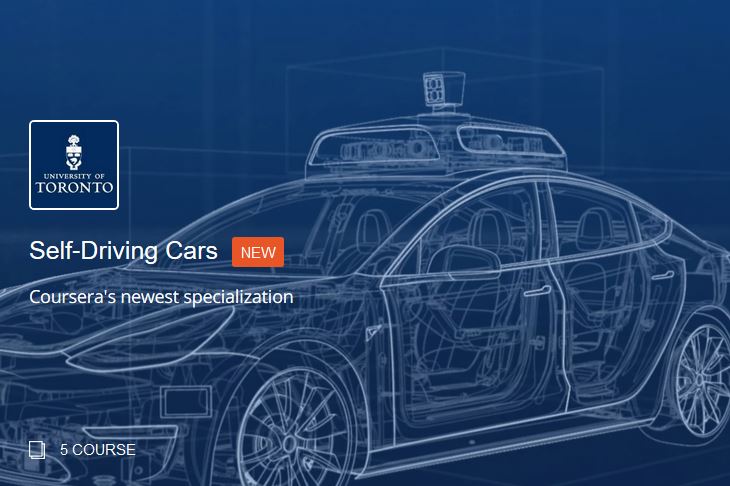
Look, you can take a specialization on self-driving cars in 4-6 months!
In this blog, we’ll go over the different tiers of education offered by Coursera and recommend different courses in GIS, data science, business, and more to advance your geospatial career.
While MOOCs are widely available and convient, they still require you to invest some time into actually completing them. How much time are you willing to invest? Is it affordable? Do you think it is feasible to complete the MOOC?
Thankfuly, Coursera offers three tiers of education, some based on 5-10 hours of learning each week:
Courses
Courses are for those who want to learn a new skill in 4-6 weeks. They include recorded video lectures, auto-graded and peer-reviewed assignments, and discussion forums. They are priced between $29-$99 USD.
Courses to take
- R Programming at John Hopkins University
- Geospatial and Environmental Analysis Course at UC Davis
- Digital Product Management: Modern Fundamentals at the University of Virginia
- Customer Insights: New Product Development Orientation at the University of Illinois Urbana-Champaign
Specializations
Specializations are for those who want to master a specific career skill in 4-6 months. Specializations are a selected series of courses, which also give the opportunity to tackle hands-on projects based on real business challenges. They are priced between $39-$79 USD per month.
Specializations to take
- GIS, Mapping, and Spatial Analysis at the University of Toronto
- Self Driving Cars at the University of Toronto
- Applied Data Science at the University of Michigan
- Managing Innovation and Design Thinking at HEC Paris
- Robotics at University of Pennsylvania
Online Degrees
Online degrees are for those who are looking for a real career transformation. The online degrees take 1-3 years of study. Coursera offers relatively affordable online degrees in business, computer science, and data science. Admission is required and it will get you an accredited master’s degree. It will cost between $15-$25,000 USD.
Online degrees to take
- MSc in Innovation and Entrepreneurship at HEC Paris
- MSc Machine Learning at Imperial College London
The decision to take some time each week to gain more skills and knowledge would undoubtedly help your geospatial career in the long-run. Thankfully, there are many options at Coursera that allow for different levels of commitment to get accredited certification. Check out Coursera for yourself to see their rich catalogue of courses!