
GALILEO – Europe’s answer to GPS and GLONASS has passed a historic milestone this week; The very first determination of a ground location using only Galileo satellites currently in orbit is now done.
This first position fix of longitude, latitude and height took place at the Navigation Laboratory at European Space Agency’s technical heart ESTEC, in Noordwijk, the Netherlands on the morning of 12 March, 2013. The position fix had an accuracy between 10 and 15 metres which is quite decent and much along expected lines taking into account the limited infrastructure and other limitations.
This milestone is a fundamental step that confirms the Galileo system is working as planned. Fixing the location of any receiver on ground requires a minimum of four satellites – in order to solve for the 4 unknowns i.e. Latitude, Longitude, Height and Time (the time is not synced between the receiver clock and satellite clock). The first two Galileo satellites were launched in October 2011, with two more added during 2012.
These four satellites were used to determine the ground location at Noordwijik, Netherlands. The location fix was the subsequent step following the testing of the satellites and the navigation messages. Navigation message send from the satellite include information regarding the satellites’ position in space expressed in Keplerian orbital parameters which are used by the receiver to calculate the distance between the satellite and it’s position which when coupled with range information from 3 more satellites helps locate the receivers’ position.
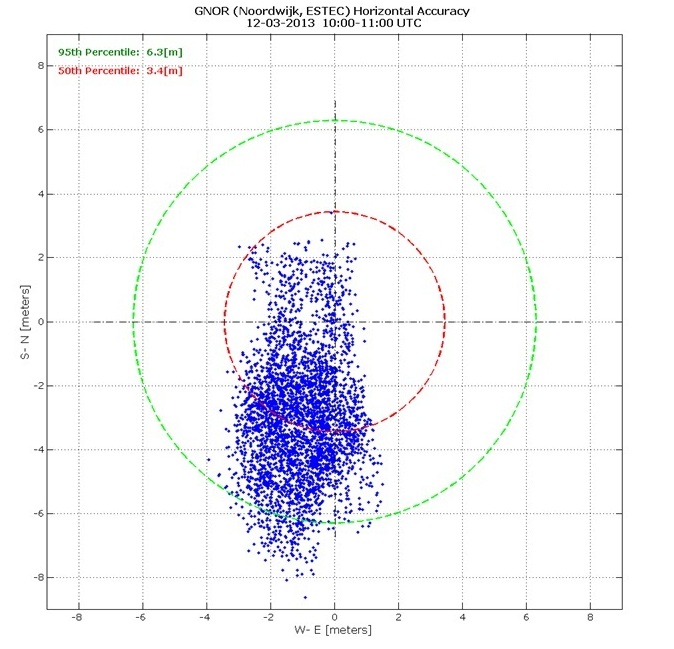
Position Fix Scatter Plot
“The test of today has a dual significance: historical and technical,” Javier Benedicto, ESA’s Galileo Project Manager.
Source: ESA


#Business


Next article
Its well known that GPS can aid in tracking vehicles and help improve the efficiency and logistics of operations.
Looks like Chennai Metrowater has realized that! Chennai is certainly one city in India where the water department has been working overtime to ensure adequate water supply given that it is not blessed with natural water bodies and the few that were present aren’t there anymore.
Chennai was recently voted as the best indian city to live in and perhaps this prompted the water department to do something. Yeah, I am bragging about my city here 😉
Enter Global Positioning! 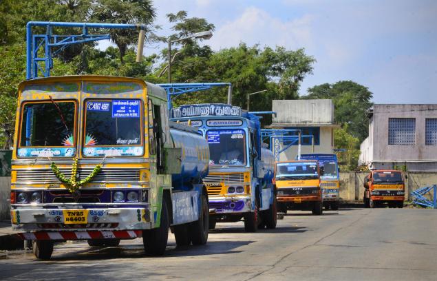
Soon, Chennai’s roads will see more water tankers, all of them fitted with Global Positioning System (GPS) equipment.
To curb increase in unaccounted tanker trips and ensure efficiency, Chennai Metrowater is in the process of fixing GPS equipment on close to 300 tankers that operate on contract basis for the water agency. The project although proposed 2 years back will now see the light of the day in less than a fortnight.
The GPS equipment would enable the water agency to monitor the tanker movement and verify if they travel on the scheduled routes. Location information provided by GPS will be received at the control room and officials would monitor the vehicles through a web-based application.
The real power and utility of any technology lies in practical implementation and problem solving. GPS has certainly established itself as a problem solver in this regard.
Source: The Hindu