
Open Geospatial Consortium (OGC) announces a new standard called Discrete Global Grid System (DGGS) that aims to the way Geospatial Information is spatially referenced to the earth.
Though the OGC standard was drafted at the beginning of the year 2017 with specifications for what constitutes a DGGS and ground rules for its definition, the standard is now accepted. The new standard defines a referencing grid to optimize the loss of geospatial data during the projection process and integrate the GIS data from various sources seamlessly. The goal of DGGS is to enable rapid assembly of spatial data without the difficulties of working with projected coordinate reference systems.
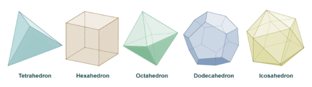
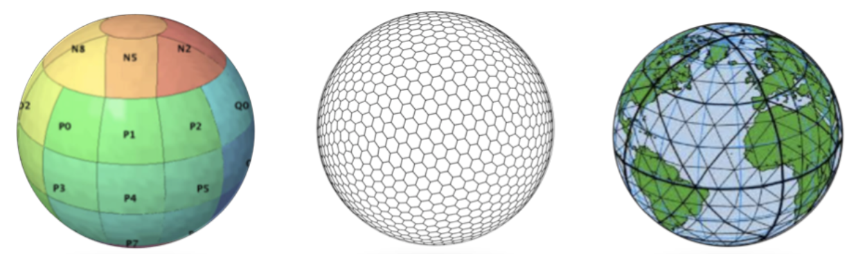
Mainly, the new reference grid contains a continous chain of polyhedrons of equal-area grids to form a hierarchical tessellation of the entire Earth.
What does this means?
A DGGS uses solid polyhedrons e.g. tetrahedrons, cubes, octahedrons to model the earth, these tessellations are inversely projected to create the reference system. So, DGGS intension is to define the required criteria and core functional algorithms to support operations of a conformant DGGS and not to intend to establish a single DGGS as a standard reference.

Representation of the five Platonic solids
So what constitutes a standard DGGS?
- The tessellation must cover the full Earth, although data referenced to it may cover only a part.
- Cells must not overlap.
- The method of cell refinement must be declared.
- At any one refinement level, cells must be of equal area. However, small deviations from exact equality of area may be permitted as long as the precision is declared.
- At each successive refinement level the total area of child cells must equal the total area of parent cells.
- Cells must have a systematic referencing system.
The DGGS is mainly meant for data modelling, processing, storage, transmission, visualization and analysis but not for navigation. A tessellation of cells must meet a set of criteria to be considered as a DGGS, including global coverage, equal area cells, single point representation per cell, and multiple levels of granularity.
Examples of DGGS based on the mapping of the faces of Platonic solids
“DGGS will provide the capability to properly integrate global geospatial, social, and economic information. It also allows communities with data attributed to fundamentally different geographies to integrate this information in a single consistent framework,” said Dr Stuart Minchin, Chief, Environmental Geoscience Division at Geoscience Australia.
Though the reference framework seems quite promising, how this new standard change the GIS business and how will it affect GIS developers and analyst the way the GIS data is modeled and maintained. Will this standard be another alternative reference system or can it entirely replaces the traditional coordinate system and becomes the “game-changer”?
References: OGC Press release, OGC Docs and EE


#Business


Next article

It took 200,000 years for our human population to reach 1 billion—and only 200 years to reach 7 billion. Check out the American Museum of Natural History’s animation above which chronicles human population over time. Awesome and inspiring.
Check out other awesome maps about the human population on Earth.