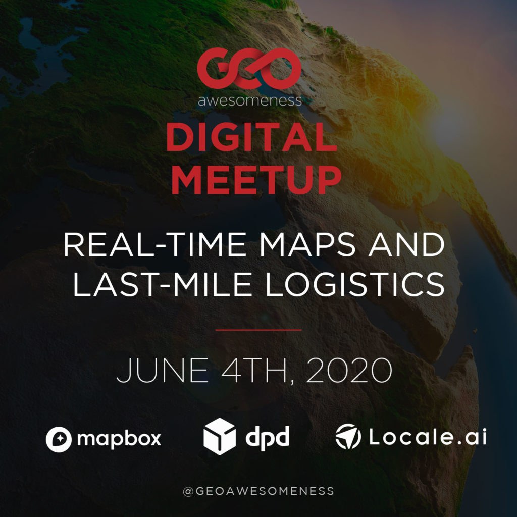
Digital Meetup #1: Real-time maps, location intelligence and logistics

It’s my pleasure to invite you all to the upcoming Digital Meetup on ‘Real-time maps, location intelligence and logistics‘ scheduled for 4th June 2020 at 16.00 UTC. We have 4 fantastic speakers from the logistics and location intelligence industries talking about their work and how geospatial data and technology are enabling the logistics industry to be more efficient and profitable.
Agenda and list of talks
- Last-mile delivery in the COVID era, Hossam Bahlool, Mapbox
- Building blocks for logistics, Max Glaisher, DPD
- Managing supply-demand gaps by combining marketing, order transactions and supply availability data, Aditi Sihna, Locale AI
- Galileo Green Lane – easing pressure at the EU’s internal borders, Kwaku Sumah, SpaceTec
Last mile delivery in the COVID era
COVID is changing the global flow of goods. Some of it temporary; some of it permanent. Let’s talk about tooling for on-demand and last mile delivery services that makes customers happy and helps scale operations.
Speaker profile:
 Hossam Bahlool is General Manager of Navigation and Driver Experiences at Mapbox, responsible for strategy and execution of a powerful set of APIs, SDKs, and driver apps for automotive and logistics. Prior to joining Mapbox, Hossam led the product management and marketing organizations at Immersion driving the adoption and monetization of haptics in digital content and devices. Previously, he led global product management and marketing at Telenav and was responsible for developing and executing the automotive product strategy and marketing vision. Before joining Telenav, Hossam co-founded Jingu Apps, the first mobile messaging discovery platform, acquired by Rebellion Media. He has held leadership positions at various high tech companies including BlackBerry, Nortel, and the Canadian Space Agency. Hossam holds a Bachelor’s degree in Computer Science from Concordia University and a Master’s degree in Business Administration from McMaster University.
Building Blocks for Logistics
Logistics company’s delivery billions of parcels every year to shops and consumers invest hundreds of millions into building efficient delivery networks that can scale to millions of parcels by managing hundreds of thousands of drivers and vehicles at thousands of locations every day! This requires T&L’s to make decisions that maximize driver time, utilisation of assets, local knowledge, as well as reliable third-party location data services for planning, navigation and route optimisation.
Speaker Profile:
Max Glaisher, Product Manager, Innovation. Background experience in software design and product management roles for 6 years in the Transportation and logistics industry. Headed up Product development at a Venture back start up called Pie Mappings/Pie io, raising £2m to solve optimisation, routing for trucks, drivers and trailers. Consulted for Automatic, and AddisonLee in Product operation roles, solving Mobility problems for consumer and taxi drivers. More recently, leading Product Innovation at DPDgroup, 2nd largest parcel delivery carrier in EU, for the past 4 years, working on re tooling location service stack and developing new product experiences for drivers, operations and millions of daily recipients.
Managing supply-demand gaps by combining marketing, order transactions and supply availability data
Locale is building a location analytics product for city and business teams who want to analyze and optimize their ground operations. Think of it like Google Analytics using location data for any company with moving things. The product converts raw location data into actionable insights to help companies make very precise data-driven decisions.
 Aditi is the co-founder of Locale.ai. Prior to starting up Locale, she used to work at a data consultancy startup, SocialCops as a research analyst working with Ministry of Rural Development, United Nations and the Rajasthan Government on a number of projects. She graduated with a Masters’s degree in Economics and Finance from BITS Pilani.
 Galileo Green Lane – easing pressure at the EU’s internal borders
In times of crisis, the importance of space assets for the safeguarding of the economy becomes more apparent. The Galileo navigation system, in particular, is a key enabler of EU responsiveness to crisis situations and has demonstrated its flexibility and utility during the COVID-19 pandemic. Galileo Green Lane is an initiative developed by the European GNSS Agency with the use of European funds to facilitate the movement of goods and freight within the EU.
Speaker profile:
 Kwaku Sumah is a Senior Consultant at a specialized space-industry consultancy firm, SpaceTec Partners. Originally from Ghana, Kwaku has since lived in three other countries and is currently living in Munich, Germany. He is passionate about the use of space technologies for socio-economic development.


#Business


Next article

Many parts of the world are now slowly opening and getting back to work, but mass gatherings continue to remain on the back burner for the foreseeable future. That doesn’t mean that the geospatial industry cannot get together virtually for knowledge-sharing and networking. Here are our top picks of the online events, conferences, and webinars about GIS and geospatial industry that you can attend this month from the comfort of your home:
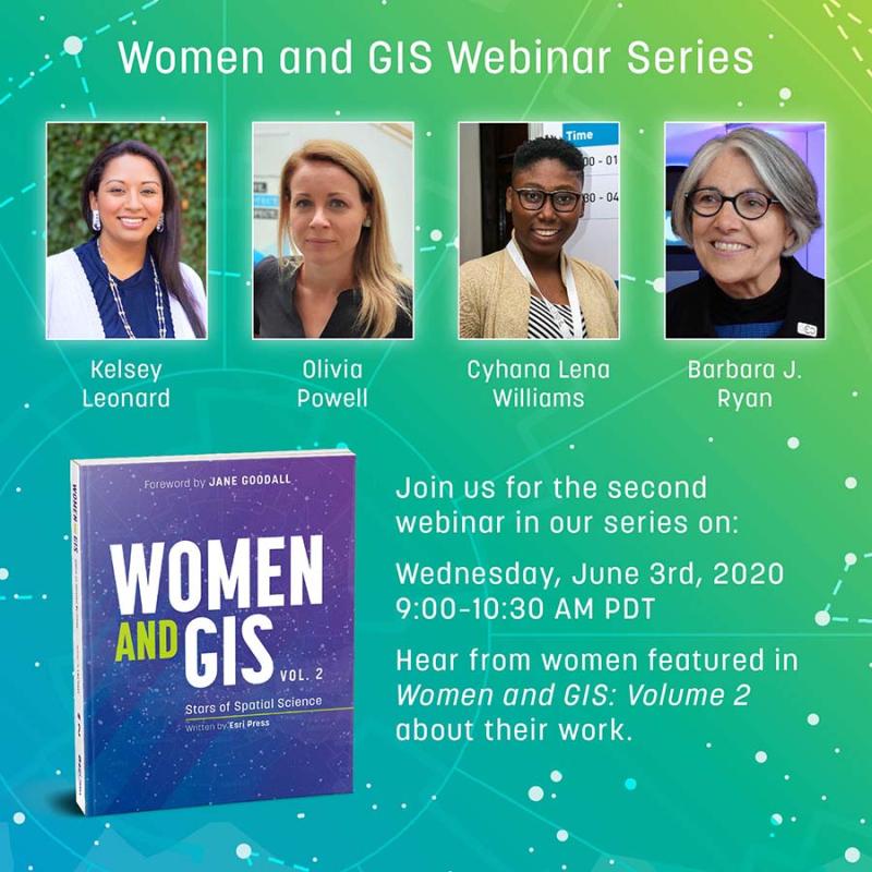
Women and GIS Webinar
When: Wednesday, June 3, 2020; 9:00-10:30 am PDT
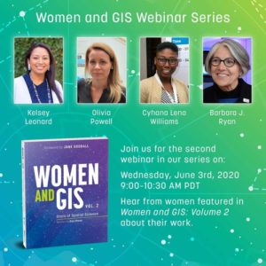
To commemorate the release of the second volume of Women and GIS! book series, Esri Press and Esri’s Women’s Enablement & Career Advancement Network (WeCan) is hosting a webinar focused on celebrating and highlighting some of the amazing women featured in Stars of Spatial Science.
You will get an opportunity to learn how women are using GIS to make a difference in government, business, conservation, crime analysis and more, and be able to ask questions directly to influential women in GIS. Presenters include Barbara Ryan, Kelsey Leonard, Olivia Powell, and Cyhana Lena Williams. Click here to register.
Geoawesomeness Digital Meetup
When: Thursday, June 4, 2020; 9:00 am PT
 Focusing on the theme of ‘Real-Time Maps and Last-Mile Logistics’, this ultimate digital event for the geospatial community will see presenters from Mapbox, DPDgroup, and Locale.ai talk about how real-time maps and analytics are helping the logistics industry become more efficient and profitable during these difficult times.
Speakers include Kwaku Sumah, Hossam Bahlool, Max Glaisher, and Aditi Sinha. Apart from a lively Q&A with the speakers, you will also have the opportunity to interact with other participants via live chat.
Sign up here now!
GEO Virtual Symposium 2020
When: June 15-19, 2020; 1:00-4:30 pm CEST
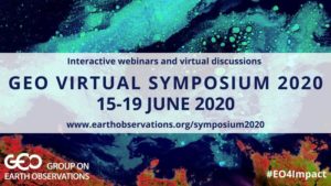 The Group on Earth Observations (GEO) is organizing a week full of interactive webinars and Ask Me Anything (AMA) sessions to highlight the value of its global network, assess the progress in achieving the aims of the GEO Strategic Plan 2016-2025, and decide on future action points.
Expect lively virtual discussions on topics such as earth observations for COVID-19 response and recovery, engaging UN agencies and intergovernmental organizations, resource mobilization and sustainable funding, co-designing capacity development, monitoring essential variables, water and coastal observations, etc.
FOSS4G UK Online 2020
When: Wednesday, June 17, 2020; 9:00 am – 5:20 pm BST
 To make a small contribution to the big holes left by the cancellation of IRL FOSS4G events, OSGeo:UK is organizing a one-day online program, divided into eight themes, running in three parallel streams. Themes include metadata, data infrastructure, core GIS stuff, land, earth observation, geospatial, COVID-19, and GeoServer.
With speakers from Deimos Space UK, MapAction, Lancaster University, Geovation, OGC, Astun Technology, GeoCat, CGI, and more, there will be nearly 40 presenters from around the world. The sessions sure look super-interesting, and mercifully, all of them will be recorded so you can catch up later if there are clashes between your favorite topics. Registrations close one day before the event. You can register here.
Think an event should be added to this list? Let us know its details in the comments!