Data-based solutions for Agri-Tech: Interview with the Remote sensing startup GreenSpin

With more than 7 billion people calling planet Earth their home, the importance of technology in Agriculture has never been greater. Every week, there are new startups cropping up, hoping to make the world a better place by integrating technology into Agriculture. I had the pleasure of talking to Dr. Sebastian Fritsch, the CEO and Founder of GreenSpin, a German startup that looks at Agri-Tech a little differently.
The Agri-Tech scene is really buzzing with activity and it’s really exciting to see a Remote sensing doctorate head an interesting company. How does GreenSpin fit into the Agri-Tech scene, what are you guys working on?
The team behind GreenSpin
We all have a background in remote sensing and GIS, our team consists of three geographers and one computer scientist. When we started in 2013, we believed that these technologies can really benefit agriculture in some way. At that time, however, we didn’t have a complete overview of the current market. Only when we began researching the market and talking to people, we realized exactly what potential Agri-Tech offers.
A lot of people in the market think that big data, including but not limited to remote sensing and other geo-data, will take agricultural productivity to the next level. Or at least, simplify a lot of complex processes. However, currently the farmer itself has no real advantage from these new developments. The data is often too complex and there is a lack of simple solutions based on these data. In addition, the farmer often loses his ability to make the actual decisions and he also has to give a lot of data about his business. Most farmers don’t like that.
A lot of people in the market think that big data, including but not limited to remote sensing and other geo-data, will take agricultural productivity to the next level. Or at least, simplify a lot of complex processes. However, currently the farmer itself has no real advantage from these new developments.
We wanted to change that to a certain extent. What we are doing at the moment is developing an online tool that simplifies the process of generating information from different data sources. The farmer can use this information directly to make decisions or generate certain maps that help in his daily operations. Fertilizer application maps are just one example. All processes will be automated, and the tool will be available for all farmers in a certain country. We will start in Germany in 2015, but we have plans to quickly expand the coverage of the tool.
Are the farmers (finally) willing to trust computers and researchers more than their age-old traditions? ☺
Of course not. And I think what you mean is “experience” 😉 But times change, and the farmers have also noticed that. Farms get bigger and are more professionally managed. Public authorities require farmers to comply with a lot of regulations. Basically, there is a need to produce more with less input. Farmers are never going to trust computers (and scientists) more than their own experience. Actually, I am glad that they don’t. The farmers are the ones with the necessary experience and training to do the best job possible, and we would never try to do their job or replace them. But what we want to do is support them as far as possible, and help them use new tools and data so that they can concentrate on the important stuff. I think farmers are finally willing to accept this help.
What exactly is Decision Farming and how is it different from Precision agriculture, Smart Farming, etc?
I know that I mentioned Decision Farming at some point, but actually I am not a big fan of these terms. There are just too many of them! Precision farming, Smart Farming, Decision Farming, Digital Cropping etc. I can’t even tell the real difference. At the core they all want the same: using new, connected technologies and data to improve agricultural efficiency and/or simplify the farmer’s life (if the latter is yet the case remains to be proven). I can only tell what we think will be important for the farmers. A few years ago, (satellite-based) precision agriculture mostly meant that the farmers got a map. This may have been a map depicting fertilizer requirements or just a map of a vegetation index. It was also probably an analog map, and the farmer was left alone in interpreting the map and deciding what to do with it. Today we have totally different technological opportunities. We want to move from maps to actual decision support. That means the farmer needs concrete tools that support him in his decision and planning processes on a daily basis.
Could you tell us a bit more the Remote sensing algorithm behind GreenSpin? What does your geospatial software infrastructure look like?
I am sorry to say, but I can’t tell you that much about it. What I can tell you is that our technology consists of a back-end and a front-end component. The back-end does all the automated data collection and processing, and we spent a lot of time and effort to ensure that this comprises all kinds of data sources. It then communicates with the front-end, our web portal/online tool. This is where the farmer logs on to and works with the information our back-end generates. The front-end offers different functionalities for the farmer, which I will be happy to show you soon after product launch in November!
I understand that you need to maintain your algorithmic secrets 😉 Could you tell us about the biggest challenge(s) that you are currently working on?
Our biggest challenge at the moment is called AGRITECHNICA 2015. It is the world’s largest agricultural fair and it will take place in November in Hannover, Germany. We will have our own booth there, and the official product launch is during this week. Until then everything has to be ready, from the product itself to marketing materials and so on. It is crazy how many tasks you have to keep track of at once!
Satellite imagery plays a crucial role in your business. I know you love Open-Data but how important do you think is the Open-Data policy of national space agencies for startups in Agri-Tech like GreenSpin?
Very important. If we would have to pay for the data, I think we wouldn’t exist right now. It is one thing that we as a company would have to buy the data. The more important point is that I believe that these costs cannot be passed on to the customer. The farmer would simply not be willing to pay for it. This has also something to do with how satellite imagery is charged for, which is by scene. So we would have to buy satellite imagery for the whole of Europe knowing that our customers only need information for a very small amount of that area. That doesn’t really make sense.
If we would have to pay for the data, I think we wouldn’t exist right now. It is one thing that we as a company would have to buy the data. The more important point is that I believe that these costs cannot be passed on to the customer.
Moving from Open-Data to Open-Source! Do you have any plans for open source projects that the community can get involved with?
Sorry to disappoint you, but not at the moment. In the next years we will be concerned with our product and making the company profitable (and be able to make a living out of it). Of course, after that we will think of such possibilities.
As someone who has studied and worked in Uzbekistan, do you think Agri-Tech startups can scale up and move across oceans, without much of an issue like Tech startups?
It is definitely not that easy for Agri-Tech startups. Of course, satellite imagery is available worldwide. The internet is also available in most of the countries that are of interest to our services. But the algorithms behind the services always need to be adapted. I can’t just take an algorithm for winter wheat crops in Central Europe and apply it to soy bean in Brazil. There will always be a need for adaptations. Then there is the issue of different data sources (weather data, soil data) that have to be integrated. But these challenges can be solved in an acceptable amount of time, and as you can imagine we are planning to do so.
GreenSpin is part of the ESA Business Incubation program, the Esri startup program and several others. How did you learn about these programs? How are you benefitting from it?
In most cases someone we knew called these programs to our attention and we took the chance to get in contact with the right persons immediately. These programs are great, because they really help startups move forward fast. The benefits differ and range from good old money, to mentoring and business support, to contributing software, server capacities and consulting. Whatever it is, we are very thankful for these programs and our partners.
You have a PhD on “Spatial and temporal patterns of crop yield”. From being a researcher to being a CEO, how has the journey been for you personally?
It was great. I absolutely love what we are doing right now and direction our company is headed. But that doesn’t mean that the journey was an easy one. Our tasks are so very different now, and mostly comprise tasks that we weren’t used to do. We had to train ourselves in most cases, although we had great mentors. The most difficult part was probably re-thinking how we approach things. What I mean is that you have to let go of a lot of ideas when you run a business. You can’t think of a problem for too long, can’t try out all different possibilities and you can’t do everything perfect. Exactly those things you do, or want to do, as a researcher. But I think we handled this pretty well.
As the CEO, what’s your vision for the company for the next years?
This one is easy. We have a clearly defined vision for the next ten years: green spin strengthens the position of the farmer as an indispensable decision-maker and by 2025 is the leading provider of data-driven solutions for precision agriculture in Europe.
As a successful Geo-Entrepreneur, what’s your advice for others who want to start their own companies?
You probably have a great technology or a great idea. But don’t go looking for problems you can solve with them. Find a market, understand it and then think about how your technology or solution can be adapted to actually solve problems in this market. Also, focus on only one product or technology and find the right team to realize it. Ideally, this team consists of people you know very well and is as motivated as you.
Thanks Sebastian, we wish you guys the very best and keep being #Geoawesome! 😉


#Ideas


Next article

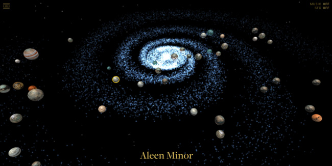
Are you also waiting for the new Star Wars: Episode VII? If yes we’ve got something for you. The design agency nlcud has put together an interactive map of The Galaxy which will allow you to explore it planet by planet.
The map has a couple of cool features. You can easily jump between planets and get info about their details like the size, year, climate, terrain, population and length of day. It also tells you what movies the film appears in. You can also sort planets by each of the films.
The app is not very impressive but if you can’t wait for December, it will be enough to make you love it:)
The app works only on Chrome.