
Mapillary is a service for crowdsourcing map photos. Using smartphones or action cams users collect images that are combined into a collective street level photo view. This is why Mapillary is often referred to as OpenStreetMap-like StreetView.
Until today Mapillary users have taken over 40 million photos. “Each of these are stitched together with computer vision – a type of artificial intelligence that extracts information from images. For every single photo uploaded, we can automatically match features to the ones in photos from the same geographic vicinity so that we can compute how the images relate to each other and how to navigate from one to the other. This is how users navigate between photos in the Mapillary app and web browser” we can read on Mapillary’s blog.
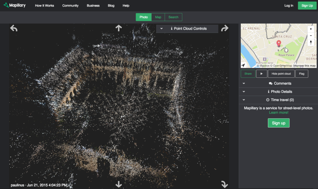
Now the company has developed a technology which takes their image data one step further. They started to use image recognition to improve positioning quality which was an issue especially in cities with tall buildings. The technique used for that purpose computes the relative camera positions and a 3D reconstruction of the environment based on images of the same area. A side effect this process is really amazing. It allows Mapillary to generate 3D point cloud models based on images.

“We couldn’t keep this to ourselves so now users can explore our underlying 3D data by simply clicking the ‘show point clouds’ option in the sidebar in your web browser. We’ve also added full support for panoramas, which enables users to move seamlessly between regular photos and panoramas in 3D, giving them a smooth and other-worldly viewing experience.”
This feature is very promising as laser point clouds are a part of 3D maps for autonomous cars. It could complement places were for some reasons Lidar data could not be captured by mapping companies like Google, TomTom or HERE.
source: Mapillary

#Business

Next article

Its amazing to see how a seemingly “boringly scientific” question turns can be turned into fascinating and informative one with the right visualization techniques and tools.
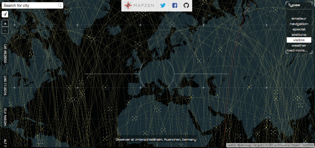
Line Of Sight by Patricio Gonzalez Vivo
Line Of Sight
“What are the satellites in your line of sight?” seems like a question that only a space science enthusiast might be interested in but then Line Of Sight, an open-data visualization by Patricio Gonzalez makes it really interesting and informative! It’s really fascinating to see how many satellites are whizzing past us every minute – here’s the link to geoawesome visualization. Satellite gazing was never this cool 😉
 More info:
If you are interested in finding out more about the code behind the project – here’s the link and here’s the link to the data behind the project. Happy satellite gazing!